Dozing in the desolated region of Himachal Pradesh, far away from hustle and bustle of city life, Spiti Valley is less heard by the majority. Situated near the Indo-China border, the region has nature’s blessing in abundance as rivers, valleys, apple orchards, lakes and mountains envelop it. It is breathtaking a view.

When I visited Kalpa in 2015, I could not succeed in my attempt to visit Spiti Valley due to time constraints. I am glad that I made up for it this time. I had heard a lot about the ‘World’s Most Dangerous Road’ from Pooh to Kaza and now it was time to take the roughest terrain. It was the most adventurous and exciting journey for me as well as for my 10-year-old son. The road was very narrow, which meant only one vehicle could pass at a time, even as the Satluj river flowed along the road.
The terrain is such that landslides are common. The role played by the Border Roads Organisation and the ITBP jawans is commendable to clear the traffic and ruble in quick time. We could have been stuck for a long time but the jawans were a blessing in disguise. You feel the nature every moment and no matter how much I write, you need to experience it to feel what it is all about.

View of Kibber village
Tabo and beyond
We reached Nako Village, which was situated at the top of the mountain with no more than 150 people living with a small lake. There was a camping site and I could spot a group of bikers, who were already settled there. We decided to take our lunch break here and more towards Tabo post lunch. To be adventurous, we did not book a place to stay, which meant it took a while to find a place in Tabo to stay. Tired after a gruelling day, we decided to call in early.
We woke up early the next morning to catch the early lights—Tabo looked stunning from the hotel’s balcony and I could hear the Spiti river singing along like a song. The first rays of the sun enveloped Tabo and the over 1,000-year-old Tabo Monastery was shining like a golden star. It was all so serene that I did not realise the trail of monks who were heading out of the monastery.

Halt at ‘World’s Most Dangerous Road
The plan for the day was to visit the monastery, which retains its ethnic appearance. We visited old caves and admired the paintings on them, which were so colourful and appealing. While taking a walk around Tabo, I also came across a small premises with 12-15 toddlers singing nursery rhymes with their cheeks fully red and full of zest. I started talking to the man running it who was all of 28 and was keen to provide the best. So the school had free mid-day meals for these kids, even though it had no funding and the school is yet to get any affiliation for government support.
We next ventured towards Dankar Monastery, before heading for Kaza, which is a small place, with one or two home-stay facilities. This being the district headquarters of Spiti Valley had a small market place, a petrol pump, and an SBI ATM. We figured that this place was used by trekkers as their base, which was evident given the number of hotel options available to suit different budgets. We decided to stay the night here.

Picturesque Kunzum La
The next day we drove towards Chandra Taal and some smaller lakes on the way. On our way we discovered Kibber—the world’s highest motorable village which rests at 14,200 feet. Kibber is a U-shaped village with less than 100 people. The Key Monastery is nearby which meant we had to visit it. This was yet another marvellous monastery which is surrounded by yellow leaf trees, giving it a pearl-in-a-golden cone feel. We stopped at Losar before we reached Chandra Taal to camp.
Kunzum Pass
Kunzum Pass connects Kullu and Lahaul with the Spiti valley, which are all very close to the snowcapped mountains. The second longest glacier—Bara Shigri—was in front of us and it looked fascinating. The winds were very strong, causing the temperature to dip but the oxygen level was comfortable. We decided to stop there for 10-15 minutes and enjoy the breathtaking view. This entire area is surrounded by Chandra Bhaga (CB) range and origins of Chandra and Bhaga Rivers merge at Tandi near Kylong and known with near name ‘Chenab’ later.

Dankar village at 12,774 ft.
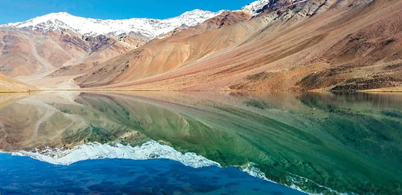
We reached Chandra Taal when we reached Tenzing campsite. This camping site was very spacious and had more than 50 tents. The camp organiser explained about the surrounding areas and suggested we acclimatise to the altitude. Chandra Taal is surrounded by snow-cap mountains which are so mesmerising that I had to really push myself to return. The experience left us captivated and I am looking forward to the next summer break to make a trip back to the hills.


